The global drone industry has developed far beyond recreational photography. Unmanned aircraft now support agriculture, construction, surveying, infrastructure inspection, logistics, emergency response and industrial operations.
This expansion has created a diverse market of drone brands and manufacturers. Some companies produce compact camera drones for individual users. Others develop enterprise platforms, autonomous aircraft, mapping systems and specialised inspection equipment.
Choosing a manufacturer therefore requires more than comparing camera resolution or advertised flight time. Buyers must assess aircraft suitability, software compatibility, operating costs, regulatory requirements and after-sales support.
A drone that performs well during a demonstration may still disappoint during daily operations. Replacement batteries might be difficult to obtain. Repairs could require international shipping. Mapping software may also introduce additional subscription costs.
The manufacturer matters because it influences the entire ownership experience. That includes aircraft design, firmware updates, accessories, training, technical assistance and product availability.
This guide examines established drone manufacturers and specialist brands. It explains their market positions, compares important product categories and identifies practical purchasing considerations.
It also examines how drone technology creates opportunities in engineering, software development, geospatial analysis and technical operations. These connections matter to professionals evaluating the industry’s longer-term career potential.
Key takeaways
- Drone manufacturers serve different markets. No single brand leads every application.
- DJI offers a broad portfolio covering consumer, professional and enterprise applications.
- Skydio focuses strongly on autonomous flight and enterprise operations.
- Parrot develops professional drone platforms with an emphasis on security-oriented applications.
- Wingtra specialises in professional mapping and surveying aircraft.
- Flyability develops drones for confined-space and challenging indoor inspections.
- Freefly Systems serves specialised cinematography and industrial imaging workflows.
- Aircraft specifications should be assessed against actual mission requirements.
- Local distributors, repair facilities and spare-parts availability can influence ownership costs.
- Regulatory compliance depends on the aircraft, operator, location and intended operation.
- Drone-related careers extend beyond piloting into robotics, software, GIS, electronics and data analysis.
Contents
Understanding the drone manufacturing industry
Drone manufacturers design, assemble and supply unmanned aircraft systems. Their products may include aircraft, controllers, sensors, batteries, communication systems and software.
The term drone manufacturer covers several different business models. Some companies manufacture complete aircraft. Others specialise in payloads, flight-control systems, software or integrated solutions.
Understanding these distinctions helps buyers identify suitable suppliers.
1. Consumer drone manufacturers
Consumer drone brands primarily target individual users and hobbyists. Their products commonly support photography, videography, travel and recreational flying.
Typical features include:
- Compact and foldable aircraft designs.
- Integrated cameras and stabilisation systems.
- Automated flight modes.
- Subject tracking and obstacle sensing.
- Smartphone or dedicated-controller operation.
- Automated return-to-home functions.
- Consumer-oriented accessories and batteries.
DJI is a prominent example of a manufacturer serving this market. Other brands include Potensic, Holy Stone, Hubsan and selected Autel Robotics products.
Consumer drones can also support professional activities. Photographers, content creators and small businesses often use capable camera drones for commercial assignments.
However, a consumer aircraft does not automatically satisfy every professional requirement. Buyers should verify operational permissions, data-handling capabilities and equipment suitability.
2. Professional and enterprise drone manufacturers
Professional drone manufacturers develop equipment for organisations with defined operational requirements.
Their customers include engineering firms, agricultural businesses, utilities, construction companies, surveyors and public-safety organisations.
Enterprise drones may offer:
- Interchangeable payloads.
- Thermal and multispectral imaging.
- High-resolution optical sensors.
- Advanced navigation systems.
- Enterprise fleet management.
- Automated mission planning.
- Secure data storage and transmission.
- Integration with business software.
- Maintenance and training programmes.
DJI Enterprise, Skydio, Parrot, Autel Robotics and Freefly Systems operate in parts of this market.
The actual capabilities vary significantly between products. Buyers should compare individual aircraft configurations rather than relying on manufacturer reputation alone.
3. Specialist drone manufacturers
Specialist manufacturers design aircraft around particular operational challenges.
A mapping company may prioritise flight endurance, geospatial accuracy and payload integration. An inspection manufacturer may prioritise collision tolerance, lighting and indoor navigation.
Examples include:
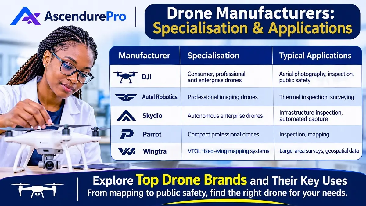
| Manufacturer | Specialisation | Example application |
|---|---|---|
| Wingtra | VTOL mapping and surveying | Large-area land surveys |
| Flyability | Confined-space inspection | Industrial tanks and infrastructure |
| Freefly Systems | Professional imaging platforms | Cinematography and industrial imaging |
| Quantum Systems | Fixed-wing and VTOL platforms | Aerial intelligence and mapping |
| Delair | Industrial fixed-wing systems | Surveying and industrial applications |
| XAG | Agricultural drone systems | Precision agriculture |
These manufacturers demonstrate why a universal ranking of drone brands can be misleading.
A specialist aircraft may deliver better results for one mission while offering little advantage for another.
4. Drone manufacturers versus drone service providers
A drone manufacturer builds or supplies equipment. A drone service provider uses that equipment to deliver services.
The distinction matters when evaluating commercial opportunities.
For example, a surveying company may purchase aircraft from Wingtra or another mapping manufacturer. It then uses those systems to deliver orthomosaics, terrain models and survey data.
Similarly, an industrial inspection business may purchase a Flyability aircraft. Its revenue comes from inspection services rather than aircraft sales.
Some organisations operate in both markets. However, equipment manufacturing and commercial drone operations require different capabilities.
Leading drone brands and manufacturers to know
The following manufacturers represent different parts of the international drone industry. They are not presented as a universal ranking.
Their suitability depends on aircraft availability, mission requirements, regulatory acceptance and support arrangements.
1. DJI
Country of origin: China
DJI is one of the most recognisable names in the global drone market. Its portfolio covers consumer camera drones, professional imaging equipment and enterprise systems.
The company has developed an extensive ecosystem around aircraft, controllers, cameras, batteries and flight software.
Its product range serves several customer groups:
- Recreational drone users.
- Aerial photographers and filmmakers.
- Real estate and media professionals.
- Surveying and mapping teams.
- Agricultural operators.
- Infrastructure inspection organisations.
- Public-safety and enterprise users.
DJI’s strengths include product variety, established accessories and a broad user community. Its extensive product ecosystem also gives buyers multiple aircraft options.
However, buyers should distinguish between consumer and enterprise models. A compact camera drone is not equivalent to an industrial inspection platform.
DJI also operates an official repair service. Its published process includes product submission, inspection, payment where applicable and return shipping.
That service does not guarantee identical repair access in every country. Buyers should confirm regional service arrangements before purchasing.
Best suited to: Buyers seeking a broad range of consumer and professional drone products.
Important consideration: Confirm local product availability, warranty coverage, software compatibility and repair arrangements.
2. Autel Robotics
International presence: China and other markets
Autel Robotics develops consumer and enterprise drone systems. Its product portfolio includes aircraft for professional imaging and industrial applications.
The EVO product family has included aircraft designed for inspection, public safety and other enterprise operations.
The EVO Max 4T illustrates the company’s enterprise positioning. Its published specifications describe an integrated system with multiple imaging capabilities and an enterprise-oriented controller.
Buyers should examine the exact configuration. Camera payloads, transmission systems and supported features can differ between versions and markets.
Autel may appeal to organisations evaluating alternatives to DJI. However, a comparison should include more than aircraft specifications.
Assess software support, replacement parts, local distributors and repair turnaround times. Also verify whether the selected model meets applicable procurement and aviation requirements.
Best suited to: Professional and enterprise buyers comparing multi-sensor aircraft and alternative equipment ecosystems.
Important consideration: Confirm the availability of the exact model and its supporting services in the intended market.
3. Skydio
Country of origin: United States
Skydio focuses on autonomous flight technology and enterprise drone applications.
Its products target public safety, infrastructure inspection, surveying, security and industrial operations.
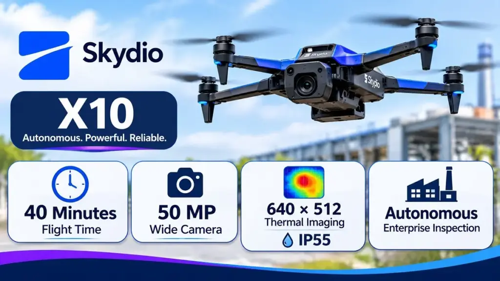
The Skydio X10 is an example of its enterprise platform. The manufacturer’s published technical specifications list several cameras, thermal imaging options, onboard computing and navigation systems.
The aircraft also incorporates obstacle-avoidance technology and autonomous flight capabilities.
Skydio’s approach places considerable emphasis on software and navigation. These capabilities can help operators conduct repeatable inspections and automated data collection.
However, autonomous functions do not eliminate operational responsibilities. Pilots and organisations must still follow applicable aviation rules and safety procedures.
Skydio also offers software and integration services. Buyers should therefore evaluate the complete system rather than treating the aircraft as an isolated product.
Best suited to: Enterprise teams requiring autonomous navigation, inspection workflows and integrated operational software.
Important consideration: Check regional availability, service access, connectivity requirements and compatibility with existing systems.
4. Parrot
Country of origin: France
Parrot develops professional drone platforms and related software.
Its ANAFI family includes compact aircraft designed for professional applications. The ANAFI USA demonstrates the company’s emphasis on security-oriented and industrial use cases.
Parrot publishes detailed technical specifications for its aircraft. The ANAFI USA documentation covers dimensions, imaging sensors, thermal capabilities, battery performance and communication systems.
The manufacturer also provides product documentation and support resources.
For government and enterprise buyers, security requirements deserve particular attention. Parrot advertises specific configurations with security-related features and procurement attributes.
Such claims should be checked against the exact aircraft, controller and software configuration. A statement about one configuration should not automatically be applied to every product.
Best suited to: Professional users evaluating compact enterprise aircraft and security-oriented equipment.
Important consideration: Verify product variants, software support, procurement eligibility and local service arrangements.
5. Wingtra
Country of origin: Switzerland
Wingtra specialises in professional mapping and surveying drones.
Its aircraft use a vertical take-off and landing fixed-wing design. This combines vertical launch capability with fixed-wing flight characteristics.
The WingtraRAY is designed for mapping and geospatial applications. Its manufacturer lists support for RGB, multispectral and LiDAR configurations.
Published specifications include up to 59 minutes of flight time for RGB and multispectral configurations. The manufacturer also lists up to 45 minutes for its LiDAR configuration.
Wingtra publishes a maximum coverage figure of 550 hectares under specified conditions. It also lists an accuracy figure of three centimetres with PPK and ground control points.
These figures are configuration- and mission-dependent. They should not be interpreted as guaranteed results for every survey.
The company’s ecosystem includes sensors, correction services, mapping software compatibility and training.
Its published hardware warranty provides 12 months of coverage. Buyers should review the actual warranty terms and confirm dealer arrangements.
Best suited to: Surveying firms, mapping professionals, construction companies and geospatial teams.
Important consideration: Evaluate survey accuracy, sensor configuration, ground control requirements and processing workflows.
6. Flyability
Country of origin: Switzerland
Flyability develops drones for indoor and confined-space inspections.
Its Elios product family targets environments where conventional aircraft may be difficult to operate.
The Elios 3 combines a protective structure with inspection sensors and navigation technology. It is designed for challenging environments such as industrial facilities and enclosed structures.
The platform supports visual inspection and optional payloads. These include LiDAR, ultrasonic thickness measurement and radiation-related equipment.
Its GPS-denied navigation capabilities are particularly relevant to indoor inspection work.
Flyability also publishes information about training, maintenance and support. Its Elios 3 product page lists service centres, training facilities and multilingual support.
These services matter because specialised inspection aircraft require appropriate operating knowledge.
Best suited to: Industrial inspection teams, asset owners and organisations working in confined or hazardous environments.
Important consideration: Confirm payload requirements, training costs, maintenance arrangements and the suitability of the aircraft for the intended environment.
7. Freefly Systems
Country of origin: United States
Freefly Systems develops professional camera movement and aerial imaging equipment.
Its products serve cinematography, production and specialised industrial imaging workflows.
The company’s drone ecosystem includes the Astro platform. Its products are designed to work with compatible imaging equipment and software.
Freefly also documents software compatibility and repair arrangements. Its support information explains that some equipment may require service at its headquarters in Washington State.
This is an important ownership consideration for international buyers. A manufacturer can provide technical support while still requiring equipment to be shipped overseas for physical repairs.
Freefly may suit professional users who value camera integration and control over imaging workflows.
Best suited to: Film production teams, professional imaging specialists and organisations requiring specialised aerial camera platforms.
Important consideration: Check payload compatibility, service location, shipping arrangements and replacement-part availability.
8. Quantum Systems
Country of origin: Germany
Quantum Systems develops unmanned aircraft systems with a strong focus on fixed-wing and vertical take-off capabilities.
Its portfolio includes platforms designed for aerial intelligence, mapping and other professional applications.
The company’s product positioning reflects the growing importance of autonomous aircraft in industrial and government operations.
Fixed-wing VTOL systems can combine efficient forward flight with vertical launch and landing. This can be useful where runways are unavailable.
However, aircraft selection still depends on operational range, payload, endurance and regulatory requirements.
Buyers should also assess the software ecosystem and training needed to operate these systems.
Best suited to: Professional organisations requiring fixed-wing or VTOL platforms for specialised missions.
Important consideration: Confirm the intended application, payload options, operational permissions and long-term support.
9. Delair
Country of origin: France
Delair develops industrial unmanned aircraft systems.
Its activities have included fixed-wing aircraft, mapping and data-oriented applications.
Fixed-wing drones can cover larger areas efficiently than many conventional multirotor systems. Their flight characteristics can make them suitable for long-distance mapping and inspection missions.
However, they may require more preparation and suitable launch or recovery arrangements.
Delair is worth examining when evaluating industrial mapping and long-range aerial data collection.
Best suited to: Industrial surveying, mapping and organisations with large-area data collection requirements.
Important consideration: Compare aircraft endurance, payload options, data processing and operational constraints.
10. XAG
Country of origin: China
XAG focuses on agricultural technology and autonomous equipment.
Its agricultural drone systems are designed for precision farming applications. These may include crop spraying and other agricultural operations.
Agricultural drones differ from camera and mapping aircraft. They require suitable liquid or spreading systems, accurate application controls and appropriate safety arrangements.
Buyers should evaluate tank capacity, application rates, field coverage and battery logistics.
They should also examine training, maintenance and access to compatible agricultural accessories.
Best suited to: Agricultural businesses, precision-farming providers and commercial crop-management operations.
Important consideration: Verify local rules governing aerial spraying, chemical handling and agricultural drone operations.
Comparing Actual Drone Models: Specifications, Performance and Applications
Manufacturer comparisons become more useful when they include specific aircraft. Two companies may serve the same industry but offer very different capabilities.
The following comparison uses published manufacturer specifications. Flight times, coverage figures and accuracy claims reflect stated test conditions. They are not guaranteed results from independent field testing.
1. Professional drone specifications at a glance
| Manufacturer | Representative model | Maximum flight time | Notable technical specification | Primary application |
|---|---|---|---|---|
| DJI | Matrice 4E | 49 minutes | 20 MP 4/3-inch camera; mechanical shutter | Surveying and mapping |
| DJI | Matrice 4T | 49 minutes | 640 × 512 thermal camera | Inspection and public safety |
| Autel Robotics | EVO Max 4T | 42 minutes | 640 × 512 thermal camera; IP43 | Inspection and emergency response |
| Skydio | X10 | 40 minutes | 50 MP wide camera; 640 × 512 thermal imaging; IP55 | Autonomous enterprise inspection |
| Parrot | ANAFI USA | 32 minutes | 500 g aircraft; 32× digital zoom | Inspection and public-sector operations |
| Wingtra | WingtraRAY | 59 minutes | Up to 550 ha coverage in one flight | Large-area surveying |
| Flyability | Elios 3 | 12.5 minutes without LiDAR | LiDAR payload option; indoor collision-tolerant design | Confined-space inspection |
| Quantum Systems | Trinity Pro | Up to 90 minutes under specified conditions | Up to 700 ha coverage in manufacturer documentation | Large-area mapping |
| XAG | P100 Pro | Mission-dependent | 50 kg rated payload; 50 L liquid tank | Agricultural spraying |
| Freefly Systems | Astro Max | Mission-dependent | Up to 3 kg maximum payload | Professional imaging and industrial sensing |
Sources: DJI Matrice 4 specifications, Autel EVO Max brochure, Skydio X10 specifications, Parrot ANAFI USA specifications, WingtraRAY specifications, Flyability Elios 3 documentation, Quantum Systems Trinity Pro technical sheet, XAG P100 Pro specifications, and Freefly Astro performance documentation.
Important: These aircraft do not belong to one interchangeable performance category. A mapping aircraft, agricultural sprayer and indoor inspection drone solve different problems. Their flight times and payload specifications should not be interpreted as direct measures of overall quality.
2. DJI Matrice 4E and Matrice 4T: Two enterprise configurations
DJI’s Matrice 4 Series illustrates how one product family can serve different professional requirements.
The Matrice 4E targets geospatial applications. The Matrice 4T adds thermal imaging and other inspection-oriented capabilities.
Both models have a published maximum flight time of 49 minutes under specified windless test conditions. Actual endurance depends on accessories, flight mode and environmental conditions.
The Matrice 4E combines a 20 MP 4/3-inch wide-angle camera with 48 MP medium-telephoto and 48 MP telephoto cameras. Its wide-angle camera also features a mechanical shutter.
That shutter is important for mapping. It helps reduce image distortion associated with rolling-shutter capture during aircraft movement.
The Matrice 4T uses a different camera configuration. Its thermal camera has a published resolution of 640 × 512 pixels.
The Matrice 4T also includes a laser rangefinder. DJI lists a measurement range of up to 1,800 metres under specified conditions.
These differences help explain why buyers should select the aircraft configuration before comparing prices.
Where each model fits
- Matrice 4E: surveying, construction mapping, mining and geospatial data collection.
- Matrice 4T: infrastructure inspection, emergency response, thermal assessment and public safety.
Sources: DJI Matrice 4 Series technical specifications and DJI Matrice 4 Series product information.
3. Autel EVO Max 4T: Enterprise imaging and thermal inspection
Autel Robotics positions the EVO Max 4T for enterprise applications.
Its published brochure lists a maximum flight time of 42 minutes. The aircraft has a maximum take-off weight of 1,999 g.
The thermal camera offers a resolution of 640 × 512 pixels. Its imaging system also includes wide-angle and zoom cameras.
The manufacturer lists an IP43 protection rating. This should not be confused with a waterproof rating.
The EVO Max Series also supports hot-swappable batteries, subject to the battery configuration.
These features make the aircraft relevant to inspection, emergency response and surveying teams. The thermal camera can help identify temperature differences during infrastructure assessments.
However, thermal resolution alone does not determine inspection quality. Lens specifications, thermal sensitivity, calibration and measurement accuracy also matter.
What buyers should verify
- Exact camera configuration.
- Battery model and compatibility.
- Thermal measurement accuracy.
- Environmental operating limits.
- Software and payload compatibility.
- Regional repair and warranty arrangements.
Sources: Autel EVO Max Series brochure and Autel thermal camera specifications.
4. Skydio X10: Autonomous navigation and enterprise imaging
Skydio’s X10 combines autonomous flight technology with a multi-camera imaging system.
Its manufacturer lists a maximum flight time of 40 minutes. The aircraft also has an IP55 protection rating.
The wide camera uses a 1-inch, 50.3 MP sensor. The narrow camera uses a 64 MP sensor.
Its thermal camera uses a Teledyne FLIR Boson+ sensor. The published thermal resolution is 640 × 512 pixels.
Skydio also lists 360-degree obstacle-avoidance coverage. This supports its focus on autonomous enterprise operations.
The aircraft is particularly relevant to infrastructure inspection and automated data capture.
However, obstacle avoidance does not eliminate collision risks. Thin wires, environmental conditions and sensor limitations still require operational attention.
The manufacturer also documents cellular connectivity options. This can support connected enterprise workflows where compatible network coverage exists.
Where the X10 fits
- Infrastructure inspection.
- Public safety.
- Construction documentation.
- Automated site capture.
- Enterprise drone operations.
Sources: Skydio X10 technical specifications and Skydio X10 technical data sheet.
5. Parrot ANAFI USA: Compact professional imaging
The Parrot ANAFI USA is a compact professional aircraft.
Its manufacturer lists a mass of 500 g and a maximum flight time of 32 minutes. The MIL version has a listed maximum flight time of 30 minutes.
Its electro-optical imaging system includes two 1/2.4-inch sensors. The wide camera captures images at up to 21 MP.
The aircraft also offers 32× digital zoom. Its thermal imaging system uses a FLIR BOSON sensor.
The published thermal photo resolution is 320 × 256 pixels. The manufacturer lists thermal sensitivity of 60 mK or better.
Parrot also documents AES-XTS SD-card encryption and encrypted wireless connections.
These features make the ANAFI USA relevant to professional inspection and security-conscious operations.
However, buyers should distinguish the aircraft’s digital zoom from optical zoom. Digital enlargement does not provide the same image detail as true optical magnification.
Where it fits
- Public-sector operations.
- Infrastructure inspection.
- Search and rescue.
- Thermal observation.
- Compact professional imaging.
Source: Parrot ANAFI USA technical specifications.
6. WingtraRAY: Mapping large areas efficiently
WingtraRAY is a VTOL fixed-wing drone designed for mapping and surveying.
Its manufacturer lists up to 59 minutes of flight time with RGB and multispectral payloads. The LiDAR configuration has a published maximum flight time of 45 minutes.
Wingtra also lists maximum coverage of 550 hectares in one flight. This figure applies to specified flight conditions and mapping settings.
The published coverage configuration uses a 120-metre altitude and 60% side overlap. It achieves a stated ground sample distance of 2.7 cm per pixel.
The manufacturer lists 3 cm absolute accuracy using PPK and ground control points.
These figures make WingtraRAY particularly relevant to large-area mapping.
The aircraft’s vertical take-off and landing design also reduces dependence on conventional runways.
Nevertheless, survey accuracy depends on the complete workflow. Ground control, camera calibration, positioning corrections and processing methods all matter.
Where it fits
- Land surveying.
- Mining and quarry mapping.
- Construction documentation.
- Large agricultural surveys.
- Infrastructure mapping.
- Geospatial data collection.
Sources: WingtraRAY product specifications and WingtraRAY technical specification document.
7. Flyability Elios 3: Inspection inside difficult environments
Flyability’s Elios 3 addresses a different problem from conventional outdoor drones.
It is designed for confined-space inspection and indoor operations.
The aircraft uses a protective cage and collision-tolerant design. This helps it operate in environments where conventional multirotor drones may be unsuitable.
Its optional LiDAR payload supports three-dimensional mapping.
Flyability’s user documentation lists approximately 12 minutes and 30 seconds of flight time without LiDAR. With the LiDAR sensor mounted, the stated flight time falls to approximately nine minutes.
That reduction illustrates an important purchasing principle: payload weight can substantially affect endurance.
The surveying payload documentation lists a LiDAR scanning rate of 1,310,720 points per second. It also lists a maximum sensor range of 100 metres.
The published precision figures are 6 mm at one standard deviation and 12 mm at two standard deviations. These figures relate to the specified sensor and measurement conditions, not a universal guarantee for every indoor survey.
Elios 3 is therefore not competing directly with long-endurance mapping drones. Its value lies in accessing difficult inspection environments.
Where it fits
- Industrial tanks.
- Boilers and furnaces.
- Tunnels and shafts.
- Confined industrial spaces.
- Infrastructure inspections.
- Indoor 3D mapping.
Sources: Flyability Elios 3, Elios 3 user manual and Flyability surveying payload specifications.
8. Quantum Systems Trinity Pro: Fixed-wing mapping and aerial data collection
Quantum Systems develops fixed-wing and VTOL unmanned aircraft.
The Trinity Pro is designed for professional mapping and aerial data collection.
Its technical sheet lists a maximum flight time of 90 minutes. However, the same document notes export-related restrictions. The default configuration is limited to 59 minutes.
The document also lists maximum coverage of 700 hectares and a data-link range of 5–7.5 kilometres.
These figures depend on the aircraft configuration and applicable restrictions.
The platform supports different imaging payloads. The technical sheet describes a 128 MP Phase One P5 mapping camera and a 61 MP Sony ILX-LR1 camera option.
This payload flexibility makes the Trinity Pro relevant to organisations collecting large-area geospatial data.
Buyers should request the current configuration sheet. They should also confirm export restrictions, payload availability and regional support.
Where it fits
- Large-area surveying.
- Aerial mapping.
- Infrastructure data collection.
- Geospatial intelligence.
- Specialist industrial applications.
Source: Quantum Systems Trinity Pro technical sheet.
9. XAG P100 Pro: Agricultural application at scale
The XAG P100 Pro is designed for agricultural spraying and spreading.
Its rated payload is 50 kg. The liquid application system includes a 50-litre smart tank.
The manufacturer lists a maximum spraying flow rate of 22 litres per minute. It also lists a spraying width of 5–10 metres, depending on operating conditions.
For granular applications, the system includes an 80-litre container. Its published maximum spreading rate is 150 kg per minute under specified test conditions.
XAG also publishes an overall crop-protection efficiency figure of up to 19 hectares per hour in open-field conditions.
These are manufacturer-reported performance figures. Actual field productivity depends on crop type, dosage, terrain, weather and operational setup.
Agricultural buyers should also consider chemical compatibility, nozzle selection and drift management.
Local rules governing aerial spraying and agricultural chemicals must be checked before operations begin.
Where it fits
- Crop spraying.
- Fertiliser spreading.
- Precision agriculture.
- Large-scale crop protection.
- Agricultural service businesses.
Sources: XAG P100 Pro product information and XAG P100 Pro technical specifications.
10. Freefly Astro: Payload flexibility for professional imaging
Freefly Systems develops professional aerial imaging platforms.
Its Astro family supports specialist imaging and sensor payloads.
The Freefly documentation lists a maximum payload of 1.5 kg for the legacy Astro configuration. The Astro Max specification lists a maximum payload of 3 kg.
Payload capacity is especially important when integrating specialist cameras and industrial sensors.
For example, Freefly documents an Astro configuration carrying its Ventus OGI payload. The typical flight time for that specific configuration is approximately 25 minutes.
That figure should not be applied to every Astro payload combination.
Buyers should evaluate the aircraft, payload, gimbal, batteries and radio system together. They should also confirm the exact Astro generation being quoted.
Where it fits
- Professional cinematography.
- Industrial imaging.
- Optical gas imaging configurations.
- Specialist sensor integration.
- Research and development.
Sources: Freefly Astro performance specifications and Freefly Ventus OGI payload specifications.
11. What these specifications actually tell buyers
The figures above demonstrate why drone selection should be mission-specific.
WingtraRAY’s 59-minute mapping configuration prioritises large-area coverage. Elios 3 accepts shorter endurance because it targets difficult indoor inspections.
XAG’s 50 kg payload addresses agricultural application. Freefly Astro’s payload flexibility supports professional imaging and specialist sensors.
Skydio X10 emphasises autonomous navigation. DJI Matrice 4E prioritises geospatial image capture.
These aircraft cannot be ranked fairly using flight time alone.
A more useful comparison asks whether the aircraft can complete the required mission, collect the necessary data and remain supportable throughout its service life.
12. Why advertised flight time is not the same as productive flight time
Maximum flight time is usually measured under controlled conditions.
Real missions introduce additional variables. These include wind, temperature, altitude, payload weight and battery condition.
The WingtraRAY documentation provides a useful example. Its RGB and multispectral configuration lists up to 59 minutes. Its heavier LiDAR configuration lists up to 45 minutes.
Flyability provides another example. Elios 3 lists approximately 12 minutes and 30 seconds without LiDAR. The figure falls to approximately nine minutes with the LiDAR payload.
Buyers should therefore request mission-specific endurance estimates.
They should also calculate battery turnaround time, reserve requirements and the number of flights needed to complete a project.
For mapping, coverage per flight may be more useful than maximum flight time. For inspection, image quality and access may matter more than endurance.
The correct metric depends on the job.
Comparing drone manufacturers by application
A practical comparison starts with the intended mission. Buyers should identify the required output before selecting a brand.
The following table provides a starting point.
| Application | Manufacturers worth evaluating | Main purchasing priorities |
|---|---|---|
| Aerial photography | DJI, Autel, Parrot | Camera quality, stabilisation and portability |
| Professional filmmaking | Freefly Systems, DJI | Camera integration, control and payload compatibility |
| Surveying and mapping | Wingtra, DJI Enterprise, Quantum Systems, Delair | Accuracy, endurance and sensor compatibility |
| Infrastructure inspection | Skydio, DJI Enterprise, Parrot | Imaging, navigation and repeatable workflows |
| Confined-space inspection | Flyability | Collision tolerance, indoor navigation and payloads |
| Agriculture | XAG, DJI Enterprise | Application systems, coverage and service support |
| Public safety | Skydio, DJI Enterprise, Parrot, Autel | Thermal imaging, reliability and data security |
| Industrial aerial data collection | Quantum Systems, Wingtra, Delair | Payload integration, endurance and processing |
The table identifies manufacturers worth researching. It does not establish that every listed aircraft meets every requirement.
A buyer should shortlist specific models and compare their actual configurations.
1. Best drone manufacturers for photography
Photography buyers should prioritise imaging quality and operational convenience.
Important specifications include:
- Camera sensor size.
- Image resolution.
- Lens quality.
- Aperture control.
- Dynamic range.
- Video resolution and frame rates.
- Gimbal stabilisation.
- Image formats.
- Low-light performance.
A high megapixel count does not automatically mean better image quality. Sensor size, lens design and image processing also matter.
Photographers should inspect original sample files where possible. Compressed promotional videos are not enough for a technical evaluation.
2. Best drone manufacturers for surveying
Surveying requires accurate and repeatable geospatial data.
A suitable aircraft may need RTK or PPK positioning, a compatible camera or LiDAR payload, and reliable mission-planning software.
The buyer should establish the required ground sample distance and positional accuracy. These are different measurements.
Ground sample distance describes the ground area represented by each image pixel. Positional accuracy describes how closely mapped coordinates match their true positions.
Surveyors should also examine ground control requirements and processing software.
A manufacturer’s accuracy claim should always be read alongside its test conditions. For example, the WingtraRAY accuracy figure is associated with PPK and ground control points.
3. Best drone manufacturers for industrial inspection
Industrial inspection involves varied environments and data requirements.
A utility inspection may require zoom cameras and thermal sensors. A confined-space inspection may require collision tolerance and indoor navigation.
Buyers should consider:
- Sensor resolution and measurement capability.
- Thermal imaging specifications.
- Lighting and low-light performance.
- Obstacle detection.
- GPS-denied navigation.
- Environmental protection.
- Data export and reporting.
- Repeatable inspection routes.
A thermal camera is not automatically suitable for every diagnostic task. Its resolution, sensitivity and calibration requirements must match the inspection objective.
4. Best drone manufacturers for agriculture
Agricultural drone buyers should distinguish between imaging and application platforms.
A mapping drone can help monitor crop conditions. A spraying drone performs a different operational role.
The selection process should consider crop type, terrain, field size and available technical support.
It should also consider chemical compatibility, application control and local agricultural regulations.
The total cost of ownership includes more than the aircraft. Pumps, nozzles, tanks, batteries and maintenance can affect operating economics.
Read more: The Rise of AgriTech in Africa
How to compare drone specifications properly
Manufacturer specifications provide useful information. However, they should not be treated as guaranteed operating results.
Test conditions, aircraft configuration and environmental factors can change actual performance.
1. Flight time and battery performance
Flight time is one of the most visible drone specifications.
Manufacturers often publish maximum flight times under controlled conditions. Actual endurance may be lower during normal operations.
Wind, payload weight, temperature and battery condition affect performance.
Buyers should ask for practical mission endurance. They should also determine the number of batteries required for a full working day.
Consider these questions:
- How long does the aircraft remain airborne with the intended payload?
- How long does each battery take to recharge?
- Can batteries be replaced in the field?
- Are spare batteries available locally?
- Does the manufacturer provide battery health monitoring?
- What is the recommended battery replacement interval?
A drone with a longer advertised flight time may not deliver better productivity. Mission preparation and battery turnaround also matter.
2. Camera and sensor quality
Camera quality depends on several interacting specifications.
For standard aerial photography, sensor size, lens quality and stabilisation are important. Surveying requires additional attention to calibration and image geometry.
Thermal imaging requires a different assessment.
Buyers should check thermal resolution, sensitivity, temperature measurement capability and radiometric file support.
Multispectral applications require suitable spectral bands and calibration procedures.
LiDAR systems should be assessed by point density, range, accuracy and compatibility with processing software.
Do not compare different sensor types using megapixels alone.
3. Transmission range and connectivity
Manufacturers may publish maximum transmission distances under favourable conditions.
These figures do not guarantee the same range in urban or obstructed environments.
Interference, buildings, terrain and radio regulations can affect connectivity.
Buyers should identify the operating environment before selecting a transmission system.
Some enterprise aircraft also support cellular connectivity. Such features depend on network coverage and compatible services.
A long advertised transmission range does not grant permission for beyond-visual-line-of-sight operations.
4. Obstacle avoidance and navigation
Obstacle avoidance can reduce certain collision risks. It does not make a drone collision-proof.
Systems may use cameras, LiDAR, radar or other sensors. Their performance depends on environmental conditions.
Thin wires, reflective surfaces, darkness and adverse weather can create challenges.
Buyers should test navigation features under realistic conditions. They should also understand the limitations described in the manufacturer’s documentation.
For indoor operations, GPS-denied navigation becomes particularly important.
Visual-inertial odometry and simultaneous localisation and mapping can help aircraft estimate position without conventional satellite positioning.
5. Weather resistance and operating conditions
An aircraft’s environmental rating should match its intended operating conditions.
Buyers should examine:
- Wind resistance.
- Operating temperature.
- Rain and dust protection.
- Maximum operating altitude.
- Humidity limitations.
- Battery temperature requirements.
An IP rating describes specific ingress-protection characteristics. It does not guarantee that an aircraft can operate safely in every weather condition.
For example, the Skydio X10 manufacturer lists an IP55 rating. That specification should be interpreted alongside the aircraft’s operating instructions.
6. Payload compatibility
Payload flexibility can determine the usefulness of an enterprise drone.
Some aircraft support interchangeable cameras and specialised sensors. Others use fixed configurations.
A buyer should confirm the complete compatibility chain.
That includes the aircraft, payload, controller, firmware, software and data-processing platform.
Do not assume that a payload from one manufacturer will work with another manufacturer’s aircraft.
7. Software and data compatibility
Drone software can influence productivity as much as the aircraft itself.
Common software functions include:
- Flight planning.
- Fleet management.
- Photogrammetry.
- 3D reconstruction.
- Thermal analysis.
- Agricultural mapping.
- Asset inspection.
- Data storage.
- Reporting and collaboration.
Buyers should identify the file formats and integrations required by their teams.
Surveying teams may need compatibility with GIS and CAD applications. Inspection teams may need asset-management integrations.
A closed software ecosystem can simplify operations. However, it may also limit flexibility.
Drone after-sales support, warranty and maintenance
After-sales support is one of the most important factors when comparing drone manufacturers.
A technically capable aircraft can become expensive if repairs take several weeks. Delays can also disrupt commercial contracts.
Support should therefore be evaluated before purchase.
1. Warranty coverage
A drone warranty typically addresses specified manufacturing defects and hardware failures.
Coverage varies by manufacturer, product and sales region.
Buyers should request the complete warranty document. They should not rely solely on a distributor’s verbal explanation.
Check the following:
- Warranty duration.
- Date when coverage begins.
- Covered components.
- Battery coverage.
- Exclusions for accidental damage.
- Water and impact damage conditions.
- Repair or replacement procedures.
- Shipping responsibilities.
- International coverage.
- Required maintenance records.
For example, Wingtra publishes a 12-month hardware warranty. Its terms specify the warranty start date and covered equipment.
Flyability’s Elios 3 pricing information also lists a 12-month warranty for the stated package.
These examples should not be generalised to every product from either company. Always check the current terms for the exact purchase.
2. Repair services and service centres
Repair availability can influence operational reliability.
Some manufacturers operate their own repair facilities. Others use authorised distributors or regional service partners.
The buyer should identify the actual repair location.
Ask whether technicians can repair the aircraft locally. Also ask which components require manufacturer-level servicing.
For international buyers, shipping may involve customs procedures and additional costs.
Freefly Systems, for example, states that certain equipment must be shipped to its headquarters in Washington State after remote troubleshooting.
This does not mean the manufacturer provides poor support. It means the buyer should understand the practical repair route.
3. Spare parts availability
Spare parts are essential for commercial drone operations.
Common replacement items include:
- Propellers.
- Motors.
- Landing gear.
- Batteries.
- Controllers.
- Cables and connectors.
- Camera components.
- Gimbal assemblies.
- Protective structures.
A manufacturer should provide clear information about replacement parts.
Buyers should also ask how long products remain supported after discontinuation.
An aircraft with an attractive purchase price may become costly if key components are difficult to obtain.
4. Technical assistance
Technical support should cover more than basic product questions.
Professional operators may need assistance with firmware, sensor configuration, flight planning and data processing.
A manufacturer should provide accessible documentation and clear escalation procedures.
Useful support channels include:
- Online knowledge bases.
- Technical documentation.
- Email support.
- Telephone assistance.
- Video troubleshooting.
- Training programmes.
- Regional service partners.
Response time matters. Ask for realistic service-level commitments where available.
5. Training and onboarding
Specialist drones often require structured training.
This is particularly important for surveying, industrial inspection and agricultural applications.
Training may cover flight operations, payload configuration, mission planning and data interpretation.
Buyers should establish whether training is included in the purchase price. They should also ask whether refresher training is available.
The best support arrangement helps customers use the aircraft safely and productively.
Total cost of ownership: What drone buyers should calculate
The purchase price is only one part of drone ownership.
A complete assessment should consider the cost of operating the aircraft throughout its useful life.
This is known as total cost of ownership.
A practical cost model includes:
| Cost category | What to include |
|---|---|
| Aircraft | Base aircraft and required configuration |
| Payloads | Cameras, thermal sensors, LiDAR and other equipment |
| Batteries | Additional batteries and replacements |
| Charging | Chargers, power supplies and field charging equipment |
| Software | Licences, subscriptions and processing tools |
| Training | Initial and refresher training |
| Insurance | Aircraft and third-party liability coverage |
| Regulatory costs | Registration, permits and operational approvals |
| Maintenance | Inspections, servicing and repairs |
| Spare parts | Propellers, motors and replacement components |
| Logistics | Shipping, customs and transportation |
| Personnel | Pilot, technician and data-processing costs |
1. Calculate the cost per mission
A useful purchasing method is to estimate the cost of a typical mission.
For example, a surveying business should estimate the cost of completing a standard mapping assignment.
Include mobilisation, flight time, battery cycles, processing and quality assurance.
Then compare the cost against the expected revenue or operational savings.
This approach is more useful than comparing aircraft prices alone.
2. Consider software subscriptions
Some manufacturers bundle software with aircraft purchases. Others sell subscriptions separately.
A low initial price may therefore lead to higher recurring expenses.
Check whether software access includes:
- Mission planning.
- Mapping and photogrammetry.
- Data storage.
- Fleet management.
- Thermal analysis.
- Advanced reporting.
- Technical support.
Also establish whether users can export their data without paying for additional services.
3. Evaluate battery replacement costs
Battery performance gradually changes with use and age.
Commercial operators should estimate battery replacement requirements.
They should also consider safe storage, charging and transportation.
Battery management is particularly important for agricultural and industrial fleets. High daily utilisation can increase replacement requirements.
4. Assess downtime costs
Equipment downtime can affect revenue and service delivery.
A drone that requires international shipping for repairs may remain unavailable longer than expected.
Buyers should consider the cost of delayed projects.
For critical operations, maintaining a backup aircraft may be financially justified.
Drone regulations and compliance: What buyers must verify
Drone regulations differ across jurisdictions.
A manufacturer cannot make an aircraft universally legal for every location and operation.
Buyers must check local requirements before importing, registering or operating equipment.
This section provides examples rather than a complete global legal guide.
1. United States: FAA requirements
The Federal Aviation Administration (FAA) regulates civil drone operations in the United States.
Commercial small-drone operations commonly fall under Part 107, subject to the rule’s applicability and operating conditions.
Remote pilots must meet the applicable certification requirements. Aircraft registration and Remote ID obligations also depend on the operation and aircraft.
The FAA explains that drones required to be registered, or voluntarily registered, must comply with applicable Remote ID requirements.
Its guidance also identifies recognised identification areas where certain aircraft can operate without standard Remote ID equipment.
Buyers should consult the FAA’s official drone registration guidance and Remote ID requirements.
A manufacturer’s statement about Remote ID should not replace checking the FAA’s accepted compliance information.
2. European Union: EASA framework
The European Union uses a risk-based regulatory framework for unmanned aircraft.
EASA guidance identifies three main operational categories:
- Open category.
- Specific category.
- Certified category.
The open category covers many lower-risk operations. It is divided into A1, A2 and A3 subcategories.
The specific category covers operations that do not meet the open-category conditions. Depending on the operation, authorisation or a declaration may be required.
The certified category covers higher-risk operations requiring more extensive certification.
The aircraft’s class identification can also affect eligibility.
EASA advises buyers to check the aircraft’s class label and EU Declaration of Conformity where required.
It also warns that aircraft purchased from outside the EU may not be intended for the European market.
Consult the official EASA drone regulations guidance before purchasing equipment for European operations.
3. Kenya: KCAA requirements
The Kenya Civil Aviation Authority (KCAA) publishes resources covering unmanned aircraft systems.
Its UAS resources include the Civil Aviation (Unmanned Aircraft Systems) Regulations, 2020, implementing standards, fees and information about approved service providers.
The regulations address several matters relevant to drone buyers.
These include:
- Eligibility to own unmanned aircraft.
- Import and export permits.
- Aircraft registration.
- Operational authorisation.
- Remote Aircraft Operators Certificates.
- Remote pilot licensing.
- Manufacturing and assembly authorisation.
Kenya’s regulations require an import permit before importing a UAS or its components. They also require aircraft registration and operational authorisation.
Commercial operators must obtain the relevant Remote Aircraft Operators Certificate.
The regulations also address remote pilot licensing and operational safety responsibilities.
Buyers should review the official Civil Aviation (Unmanned Aircraft Systems) Regulations, 2020 and current KCAA guidance.
Do not assume that purchasing a drone from an international online retailer completes the import process.
Before ordering, confirm the applicable permit requirements with KCAA. Also verify whether the selected model and intended operation can satisfy the authority’s requirements.
4. Government and security requirements
Some organisations have additional procurement and cybersecurity requirements.
These may apply to government agencies, defence contractors, public-safety departments and critical infrastructure operators.
Buyers may encounter terms such as NDAA compliance, TAA compliance and Blue UAS.
These terms are not interchangeable.
A procurement-related designation does not automatically establish aviation approval in every jurisdiction. Nor does it guarantee that an aircraft meets every organisation’s cybersecurity requirements.
Buyers should request the specific documentation required by their procurement authority.
They should also examine data storage, encryption, software updates and third-party integrations.
5. International buyers: Questions to resolve before importing
Before importing a drone, establish the following:
- Does the destination country require an import permit?
- Can the aircraft be registered?
- Does the model meet applicable technical requirements?
- Are there restrictions on radio frequencies?
- Does the aircraft support required identification features?
- Is the intended operation permitted?
- Are pilot training and licensing requirements satisfied?
- Is third-party insurance required?
- Can the manufacturer provide local support?
- Are replacement batteries and components available?
These checks reduce the risk of buying equipment that cannot be used as intended.
Drone manufacturers and emerging technology trends
Drone manufacturing continues to evolve through advances in robotics, artificial intelligence, sensors and communication systems.
These developments affect both aircraft design and commercial applications.
1. Artificial intelligence and autonomous flight
Artificial intelligence supports several drone functions.
These include object detection, navigation assistance, obstacle avoidance and automated data collection.
Autonomous flight can improve repeatability during inspections and mapping operations.
However, autonomy does not remove the need for operational supervision. Human oversight, risk management and regulatory compliance remain important.
Skydio’s product ecosystem illustrates the growing role of onboard computing and autonomous navigation.
2. Beyond-visual-line-of-sight operations
Beyond-visual-line-of-sight operations allow drones to operate beyond the pilot’s direct visual observation.
These operations could support infrastructure monitoring, logistics and long-distance inspection.
However, BVLOS operations are subject to specific regulatory and safety requirements.
Aircraft capability alone does not authorise BVLOS flight.
Operators must satisfy the relevant approval process in their jurisdiction.
3. Improved battery technology
Battery technology affects flight endurance, payload capacity and operating costs.
Manufacturers continue to work on more efficient aircraft and battery systems.
For commercial operators, battery improvements can increase productive flight time.
However, endurance claims must be evaluated against payload weight and operating conditions.
Charging infrastructure and battery replacement costs remain important considerations.
4. LiDAR and advanced imaging
LiDAR technology supports three-dimensional mapping and measurement.
It is particularly useful in surveying, construction, forestry and infrastructure applications.
Multispectral imaging can support agricultural monitoring and environmental analysis.
Thermal imaging helps identify temperature patterns during inspections.
These payloads create demand for more specialised aircraft and data-processing capabilities.
5. Drone fleet management
Organisations operating multiple aircraft need systems for fleet oversight.
Fleet management software can help coordinate pilots, aircraft, batteries and maintenance schedules.
It may also support mission planning, flight logs and data management.
Enterprise buyers should evaluate whether the manufacturer’s platform integrates with their existing systems.
6. Cybersecurity and data protection
Drone systems collect sensitive information.
This may include images of buildings, infrastructure, private property and industrial facilities.
Organisations should evaluate how aircraft store and transmit data.
Important questions include:
- Is data encrypted during transmission?
- Is stored data encrypted?
- Where is cloud data hosted?
- Who can access flight records?
- How are software updates authenticated?
- Can administrators control user permissions?
- Does the system support offline workflows?
Security should be evaluated across the aircraft, controller, mobile application and cloud platform.
Drone manufacturing and related career opportunities
The drone industry creates opportunities beyond remote piloting.
Manufacturers require professionals who design, assemble, test and maintain complex systems.
Software companies develop tools for flight planning, navigation and data analysis. Commercial operators also require pilots, technicians and specialists.
This makes the industry relevant to people exploring engineering, technology and geospatial careers.
1. Drone engineering
Drone engineers work on aircraft design and system integration.
Their responsibilities may include:
- Airframe design.
- Aerodynamics.
- Structural analysis.
- Propulsion systems.
- Battery integration.
- Payload mounting.
- Flight testing.
- Reliability engineering.
Relevant disciplines include aerospace engineering, mechanical engineering and mechatronics.
2. Robotics and autonomous systems
Robotics specialists develop technologies that help drones perceive and interact with their environments.
Their work may involve sensor fusion, navigation and motion planning.
Relevant skills include:
- Robotics.
- Control systems.
- Computer vision.
- Embedded programming.
- Sensor integration.
- Autonomous navigation.
- Simulation.
These capabilities are increasingly important for inspection and autonomous flight applications.
3. Drone software development
Software developers build applications that support drone operations.
Their work may cover mobile applications, web platforms, flight-control software and data-processing systems.
Useful technical skills include Python, C++, JavaScript and embedded systems programming.
Knowledge of APIs, databases and cloud computing can also be valuable.
4. GIS and geospatial analysis
GIS professionals work with spatial data and geographic information systems.
Drone-generated imagery can support mapping, planning and environmental monitoring.
Relevant technical skills include:
- Geographic information systems.
- Photogrammetry.
- Remote sensing.
- Spatial analysis.
- Cartography.
- Data visualisation.
- Coordinate reference systems.
These skills connect drone operations with surveying, agriculture, construction and environmental applications.
5. Drone maintenance and technical support
Maintenance specialists help keep aircraft operational.
Their responsibilities may include inspections, component replacement and troubleshooting.
Useful skills include electronics, diagnostics and mechanical repair.
Manufacturers and distributors may also require customer support specialists and field technicians.
6. Drone operations and data services
Remote pilots operate aircraft and collect mission data.
However, professional drone operations require more than flying skills.
Operators need risk assessment, mission planning and knowledge of aviation regulations.
Data specialists may then process images, create maps and prepare reports.
This creates several possible career paths:
| Career path | Relevant skills |
|---|---|
| Remote pilot | Flight operations, safety and mission planning |
| Drone engineer | Aerospace, mechanical and electronics engineering |
| Robotics engineer | Control systems, computer vision and autonomy |
| Embedded software developer | C++, microcontrollers and hardware integration |
| GIS analyst | Spatial analysis, mapping and remote sensing |
| Photogrammetry specialist | Image processing and 3D reconstruction |
| Drone maintenance technician | Electronics, diagnostics and repair |
| Agricultural drone specialist | Precision agriculture and application systems |
| Technical support engineer | Troubleshooting and customer support |
| Drone data analyst | Data processing, visualisation and reporting |
7. Preparing for drone-related jobs
People interested in drone careers should identify the specific role they want to pursue.
A remote pilot needs different competencies from a robotics engineer. A GIS analyst also needs a different technical portfolio.
Candidates should build practical evidence of their skills.
Useful portfolio projects include:
- A sample aerial mapping project.
- A 3D reconstruction from drone imagery.
- A GIS analysis using geospatial data.
- A computer-vision prototype.
- A simulated autonomous navigation project.
- A documented aircraft maintenance exercise.
Professional development should combine technical knowledge with communication and problem-solving skills.
Candidates can use AscendurePro Career Guides to research career paths and improve their job-search preparation.
The AscendurePro job board can also help users monitor relevant opportunities. Search for roles involving GIS, robotics, engineering, software development and technical support.
Applicants preparing for these positions can use AscendurePro Launchpad to build resumes, tailor applications and practise interviews.
How to choose the right drone manufacturer
Selecting a manufacturer should follow a structured evaluation.
The process below helps buyers avoid choosing equipment based on marketing claims alone.
Step 1: Define the mission
Start by describing the task the aircraft must perform.
Identify the operating environment, required payload and expected output.
For example, a land survey requires different equipment from an indoor inspection.
Avoid purchasing a drone before defining the operational requirements.
Step 2: Identify the required aircraft type
Drone designs have different advantages.
Multirotor aircraft can take off vertically and hover. They are useful for photography, inspection and many short-range operations.
Fixed-wing aircraft can cover larger areas efficiently. However, they generally require suitable launch and recovery arrangements.
VTOL fixed-wing aircraft combine vertical take-off and landing with forward-flight characteristics.
Specialist aircraft may also include protective cages or specialised agricultural application systems.
Step 3: Shortlist suitable manufacturers
Identify manufacturers with products designed for the intended application.
Compare at least two or three suitable aircraft where practical.
Use official product documentation as the starting point.
Do not compare unrelated models simply because they share a similar purchase price.
Step 4: Compare technical specifications
Build a comparison sheet covering:
- Maximum take-off weight.
- Practical flight endurance.
- Payload capacity.
- Camera or sensor specifications.
- Navigation technology.
- Transmission systems.
- Environmental ratings.
- Operating temperature.
- Supported software.
- Battery charging time.
Record the exact model and configuration.
This prevents confusion between different versions of the same aircraft.
Step 5: Verify regulatory eligibility
Check whether the aircraft can be imported, registered and operated in the intended location.
Review identification, radio and technical requirements.
Confirm whether the intended operation requires additional authorisation.
For commercial use, establish the applicable operator and pilot requirements.
Step 6: Evaluate after-sales support
Ask the manufacturer or distributor for written support information.
Confirm repair locations, warranty terms and spare-parts availability.
Request realistic repair turnaround estimates.
Where possible, speak to existing customers using the same aircraft.
Step 7: Calculate total cost of ownership
Include aircraft, payloads, software, batteries, training and maintenance.
Estimate operating costs over the expected ownership period.
Consider downtime and replacement equipment.
Step 8: Request a demonstration
A demonstration can reveal practical limitations.
Test the aircraft using the intended payload and operating workflow.
Where possible, use representative field conditions.
For mapping equipment, examine sample outputs. For inspection drones, test navigation and image quality.
Step 9: Review the purchase agreement
Confirm what the supplier will deliver.
The agreement should identify aircraft configurations, accessories and software entitlements.
It should also specify warranty coverage, delivery arrangements and support responsibilities.
Step 10: Plan for long-term operations
Establish procedures for maintenance, battery management and pilot training.
Plan how flight records and mission data will be stored.
Assign responsibility for firmware updates and equipment inspections.
A good purchase should support the organisation’s operational needs over time.
Common mistakes when comparing drone brands
Even experienced buyers can overlook important factors.
The following mistakes can lead to unnecessary costs.
1. Choosing the cheapest drone
A low purchase price may hide expensive ownership requirements.
The aircraft may have limited spare parts or weak software support.
It may also lack the payload needed for professional work.
Compare total cost of ownership rather than price alone.
2. Assuming the most famous brand is always best
Brand recognition does not guarantee suitability.
A specialist manufacturer may provide a better solution for a particular mission.
Compare the aircraft’s capabilities against the actual task.
3. Relying entirely on advertised flight time
Maximum flight time is not the same as practical mission endurance.
Payloads and weather conditions affect performance.
Request realistic operating figures and test the aircraft where possible.
4. Ignoring software compatibility
An aircraft may collect excellent data but create problems during processing.
Check whether the software integrates with existing business systems.
Confirm file formats, licensing and data export options.
5. Overlooking local repair arrangements
A manufacturer’s international reputation does not guarantee local repair facilities.
Ask where damaged aircraft will be serviced.
Check the cost and expected duration of shipping.
6. Confusing procurement compliance with aviation approval
A procurement designation does not automatically authorise flight.
Aircraft must satisfy the relevant aviation requirements.
Buyers should also verify any additional organisational security requirements.
7. Buying without checking import requirements
Import restrictions can affect delivery and ownership.
Some jurisdictions require permits before aircraft or components enter the country.
Check the applicable process before placing an order.
8. Failing to budget for training
Specialist aircraft can require technical training.
This is particularly relevant for surveying, industrial inspection and agricultural applications.
Include training costs in the original budget.
FAQs about drone brands and manufacturers
Which is the best drone manufacturer in the world?
There is no single best drone manufacturer for every application. DJI offers a broad product ecosystem, while Skydio, Wingtra and Flyability focus on different professional requirements. The best choice depends on the aircraft’s intended mission, budget and support arrangements.
Which drone brands are best for professional use?
DJI Enterprise, Skydio, Parrot, Autel Robotics, Wingtra, Flyability and Freefly Systems are worth evaluating. Their products serve different professional applications. Buyers should compare specific models and configurations rather than brand names alone.
Which drone manufacturer is best for surveying?
Wingtra is a specialist manufacturer worth considering for professional mapping and surveying. Other options include DJI Enterprise, Quantum Systems and Delair. Selection should depend on accuracy requirements, payload compatibility, endurance and processing software.
Are DJI drones suitable for commercial operations?
Some DJI aircraft are used in commercial operations. However, suitability depends on the model, payload and intended mission. Operators must also satisfy local aviation regulations and any relevant procurement requirements.
Which drone manufacturers offer industrial inspection drones?
Skydio, DJI Enterprise, Parrot and Flyability offer platforms relevant to industrial inspection. Flyability is particularly specialised in confined-space inspections. The correct choice depends on sensor requirements and the inspection environment.
How important is after-sales support when buying a drone?
After-sales support is essential for long-term operations. Buyers should examine warranty terms, repair locations, spare-parts availability and technical assistance. These factors can affect downtime and total ownership costs.
Can I import a drone into Kenya?
Kenya’s UAS regulations address import permits, registration and operational authorisation. Buyers should consult KCAA before importing an aircraft or components. They should also confirm the requirements for their intended operation.
Conclusion
Drone brands and manufacturers serve a wide range of customers and industries. Their products differ in aircraft design, payload capabilities, software and support arrangements.
DJI provides a broad product ecosystem. Skydio focuses strongly on autonomous enterprise operations. Parrot develops professional platforms, while Wingtra specialises in mapping and surveying.
Flyability addresses confined-space inspection. Freefly Systems serves specialised imaging workflows, while manufacturers such as XAG focus on agriculture.
The best drone manufacturer is therefore the one that meets the buyer’s operational requirements. Specifications, compliance, software compatibility and after-sales support should guide the decision.
Buyers should also calculate total cost of ownership before committing to a purchase. Local repair access and replacement-part availability can matter as much as advertised performance.
For professionals, the industry offers opportunities across engineering, robotics, GIS, software development, maintenance and commercial operations. Understanding these technologies can help readers identify both suitable equipment and potential career directions.
References and further reading
The following sources provide official product information, technical documentation and regulatory guidance. Manufacturer specifications represent published claims and should be checked against the exact product configuration.
- European Union Aviation Safety Agency. (n.d.). Drones (UAS): Frequently asked questions. https://www.easa.europa.eu/en/the-agency/faqs/drones-uas
- European Union Aviation Safety Agency. (n.d.). Open category: Low-risk civil drones. https://www.easa.europa.eu/en/domains/drones-air-mobility/operating-drone/open-category-low-risk-civil-drones
- Federal Aviation Administration. (n.d.). How to register your drone. https://www.faa.gov/uas/getting_started/register_drone
- Federal Aviation Administration. (n.d.). Remote identification of drones. https://www.faa.gov/uas/getting_started/remote_id
- Kenya Civil Aviation Authority. (n.d.). Unmanned Aircraft Systems (Drones). https://kcaa.or.ke/safety-security-oversight/unmanned-aircraft-systems
- Kenya Law. (2020). The Civil Aviation (Unmanned Aircraft Systems) Regulations, 2020 (Legal Notice No. 42 of 2020). https://new.kenyalaw.org/akn/ke/act/ln/2020/42/eng@2020-04-03/source
- DJI. (n.d.). DJI official website. https://www.dji.com/
- DJI Support. (n.d.). Repair service application instructions. https://support.dji.com/help/content?customId=01700006865&lang=en&re=SE&spaceId=17
- Autel Robotics. (n.d.). Official website. https://www.autelrobotics.com/
- Autel Robotics. (n.d.). EVO Max 4T general specifications. https://shop.autelrobotics.com/pages/evo-max-4t-general-specifications
- Skydio. (n.d.). Skydio X10 technical specifications. https://www.skydio.com/x10/technical-specs
- Parrot. (n.d.). ANAFI USA technical specifications. https://www.parrot.com/en/drones/anafi-usa/technical-specifications
- Wingtra. (n.d.). WingtraRAY: Survey and mapping drone. https://wingtra.com/ray/
- Wingtra. (2024). Hardware warranty. https://wingtra.com/warranty/
- Flyability. (n.d.). Elios 3: Confined-space inspection drone. https://www.flyability.com/elios-3
- Flyability. (n.d.). Elios 3 pricing and package information. https://www.flyability.com/elios-3-price
- Freefly Systems. (n.d.). Freefly Systems official website. https://freeflysystems.com/
- Freefly Systems. (n.d.). Service and repair information. https://freeflysystems.com/knowledge-base/how-can-i-send-in-a-movi-alta-or-other-freefly-accessory-for-service-or-repair
- Quantum Systems. (n.d.). Quantum Systems official website. https://quantum-systems.com/
- Delair. (n.d.). Delair official website. https://delair.aero/
- XAG. (n.d.). XAG official website. https://www.xa.com/